
NASA’s Applied Remote Sensing Training Program (ARSET) has opened registration for a new open, online webinar series: Remote Sensing for Mangroves in Support of the UN Sustainable Development Goals. This 3-part series (November 5, 12, 19) focuses on mapping and monitoring mangroves and how it relates to UN sustainable development indicator 6.6.1: Change in the extent of water-related ecosystems over time. Indicator 6.6.1 is used in determining progress toward meeting Sustainable Development Goal 6, which is to “Ensure availability and sustainable management of water and sanitation for all.”
If you would like to join us or pass along to colleagues who will find it useful, please do so. Please see the training details and registration information below.
Remote Sensing for Mangroves in Support of the UN Sustainable Development Goals
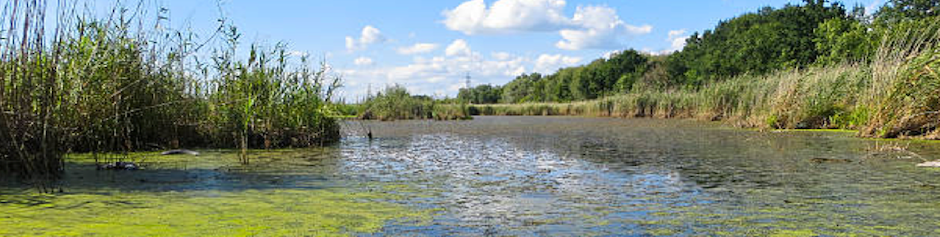
Understanding mangrove ecosystems and mapping their extent is critical to meeting this goal. Mangroves are critical ecosystems, provide coastal protection from storm surges, maintain our climate, control floods, and stabilize coastlines. Additionally, they serve as nurseries for a number of marine wildlife species. Mangroves are also integral to the blue carbon family. Blue carbon is carbon stored, sequestered, or released from coastal vegetation ecosystems (Heer et al. 2012). Therefore, understanding mangrove extent and biomass is essential to managing the sustainability of our water ecosystems. Attendees will be exposed to the latest tools for mapping mangrove extent in Google Earth Engine and how these observations can be used to report towards SDG quotas.
Relevant UN Sustainable Development Goal:
- Target 6.6: By 2020, protect and restore water-related ecosystems, including mountains, forests, wetlands, rivers, aquifers and lakes
Course Dates: November 5, 12, 19
Times: 10:00-11:30 & 15:00-16:30 EST (UTC-5); There will be identical sessions at two different times of the day. Participants need only to register and attend one daily session.
Register Here
Learning Objectives: By the end of this training, participants will:
- Understand Sustainable Development Goals with a focus on understanding SDG 6.6.1
- Understand the importance of mangrove ecosystems and the need for mapping them using satellite technology
- Have knowledge of spatial data that is available for studying mangrove ecosystems
- Use Google Earth Engine to:
- Map country-specific mangrove extent (Case Study: Guyana)
- Perform a time series analysis of mangrove ecosystems
- Calculate mangrove extent in hectares
- Build an app to display data using results from Guyana
Audience: National policymakers involved in sustainable development commitments to mangrove and water-related ecosystem conservation and the UN’s Sustainable Development Goals (SDGs).
Course Format: Three, one-and a half hour sessions