
Groundwater Monitoring using Observations from NASA’s Gravity Recovery and Climate Experiment (GRACE) Missions (June 25, 2020)
Bilingual (English and Spanish)
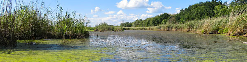
Groundwater makes up roughly 30% of global freshwater. It also provides drinking water for the world’s population, and irrigation for close to 1/3rd of global agricultural land. Because of this level of reliance, monitoring groundwater is crucial for water resources and land management. The Gravity Recovery and Climate Experiment (GRACE) and GRACE-Follow On (GRACE-FO) missions from NASA and the German Research Centre for Geosciences (GFZ) provide large-scale terrestrial water storage estimation from mid-2000 to present. The mission uses twin satellites to accurately map variations in the Earth's gravity field and surface mass distribution.
GRACE observations have been used for detecting groundwater depletion and for drought and flood predictions. This lightning-style training is designed to answer the demand and interest from the applications community in technologies that can be used to support water resources management. The webinar will provide an overview of the GRACE missions, groundwater data availability, and their applications in the monitoring and management of water resources. This lightning webinar will also serve as the foundation for the upcoming advanced webinar: Using Earth Observations to Monitor Water Budgets for River Basin Management II.
Course Date and Times: June 25, 2020
- Register Here: English (11:00-12:30 ET)
- Register Here: Spanish (14:00-15:30 ET)
Learning Objectives: By the end of this training, attendees will be able to access GRACE data and analyze regional groundwater changes
Course Format: A single, 1.5-hour webinar that includes a lecture and a question & answer session; One session offered in English (11:00-12:30 ET) and one in Spanish (14:00-15:30 ET)
Audience: The content of this training was developed for local, regional, state, federal, and international organizations engaged in the management of water resources, irrigation, and agricultural management.
Relevant UN Sustainable Development Goals:
Target 6.4: By 2030, substantially increase water-use efficiency across all sectors and ensure sustainable withdrawals and supply of freshwater to address water scarcity and substantially reduce the number of people suffering from water scarcity
Retweet Option: English: https://twitter.com/
Retweet Option: Spanish: https://twitter.com/
Understanding Phenology with Remote Sensing (June 30, July 7, 14, 2020)
This training will focus on the use of remote sensing to understand phenology: the study of life-cycle events. Phenological patterns and processes can vary greatly across a range of spatial and temporal scales, and can provide insights about ecological processes like invasive species encroachment, drought, wildlife habitat, and wildfire potential. This training will highlight NASA-funded tools to observe and study phenology across a range of scales. Attendees will be exposed to the latest in phenological observatory networks and science, and how these observations relate to ecosystem services, the carbon cycle, biodiversity, and conservation.
Course Dates: June 30, 2020. July 7,14, 2020
Time: 11:00 AM - 12:00 PM EDT (UTC-4)
Learning Objectives: By the end of this training series, attendees will be able to:
- Summarize NASA satellites and sensors that can be used for monitoring global phenology patterns
- Outline the benefits and limitations of NASA data for phenology
- Describe the multi-scalar approach to vegetation life cycle analyses
- Compare and contrast data from multiple phenology networks
- Evaluate various projects and case-study examples of phenological data
Course Format: Three, one-hour sessions
Audience: This training is designed for individuals and organizations interested in using satellite imagery for mapping vegetation health and seasonal patterns.
Relevant UN Sustainable Development Goals:
Goal 13: Take urgent action to combat climate change and its impacts
Goal 15: Protect, restore and promote sustainable use of terrestrial ecosystems, sustainably manage forests, combat desertification, and halt and reverse land degradation and halt biodiversity loss
Retweet Option: https://twitter.com/
Advanced Webinar: Using Earth Observations to Monitor Water Budgets for River Basin Management II (July 21, 28,August 4, 2020)
Rivers are a major source of freshwater. They support aquatic and terrestrial ecosystems, provide transportation, generate hydropower, and when treated, provide drinking and agricultural water. Estimating and monitoring water budgets within a river basin is required for sustainable management of water resources and flooding within watersheds. This advanced-level webinar series will focus on the use of NASA Earth observations and Earth system-modeled data for estimating water budgets in river basins.
Past ARSET trainings on monitoring water budgets for river basins focused on data sources relevant for river basin monitoring and management, and provided case studies for estimating the water budget of a watershed using remote sensing products. This advanced webinar will include lectures and hands-on exercises for participants to estimate water budgets for a given river basin.
Course Dates: July 21, 28, and August 4, 2020.
Times: 10:00-12:00 & 16:00-18:00 EDT (UTC-4); There will be identical sessions at two different times of the day
Register Here
Learning Objectives: By the end of this training, attendees will be able to:
- Identify and access remote sensing and Earth system-modeled data for estimating water budgets in a river basin
- Explain the uncertainties involved in estimating water budgets for river basins
- Replicate the steps for estimating water budgets for a river basin and sub-watersheds using remote sensing products and GIS
Course Format: Three, two-hour parts that include lectures and demonstrations, exercises, and question and answer sessions. Each webinar will be broadcast in English with training materials available in Spanish.
Audience: The content of this training was developed for local, regional, state, federal, and international organizations engaged in the management of water resources, river basins, floods, droughts, land development, river transportation, hydroelectric power, and reservoirs.
Relevant UN Sustainable Development Goals:
Target 6.4: By 2030, substantially increase water-use efficiency across all sectors and ensure sustainable withdrawals and supply of freshwater to address water scarcity and substantially reduce the number of people suffering from water scarcity
Target 6.5: By 20Retweet Option:30, implement integrated water resources management at all levels, including through transboundary cooperation as appropriate
Retweet Option: https://twitter.com/